Ari Cacic

UMBC Class of 2021, B.S. Environmental Science and Geography, GIS Certificate.
Tom Rabenhorst Award for Geospatial Techniques Recipient. NOAA Ernest F. Hollings Undergraduate Scholar. Sondheim Public Affairs Scholar.
View My LinkedIn Profile
The goal of this project is to visualize how historic redlining in Baltimore city has resulted in a racially- and socioeconomically-segregated landscape. More specifically, I’ve created outputs that display how these once redlined areas have impacted racial makeup of certain communities and the abundance and locations of public housing projects throughout Baltimore.
My first output is a map showing what percentage of the 2010 population in each historically redlined area is black. Each redlined area is labeled with it’s HOLC ranking and is symbolized based on what percent of the total population is black.

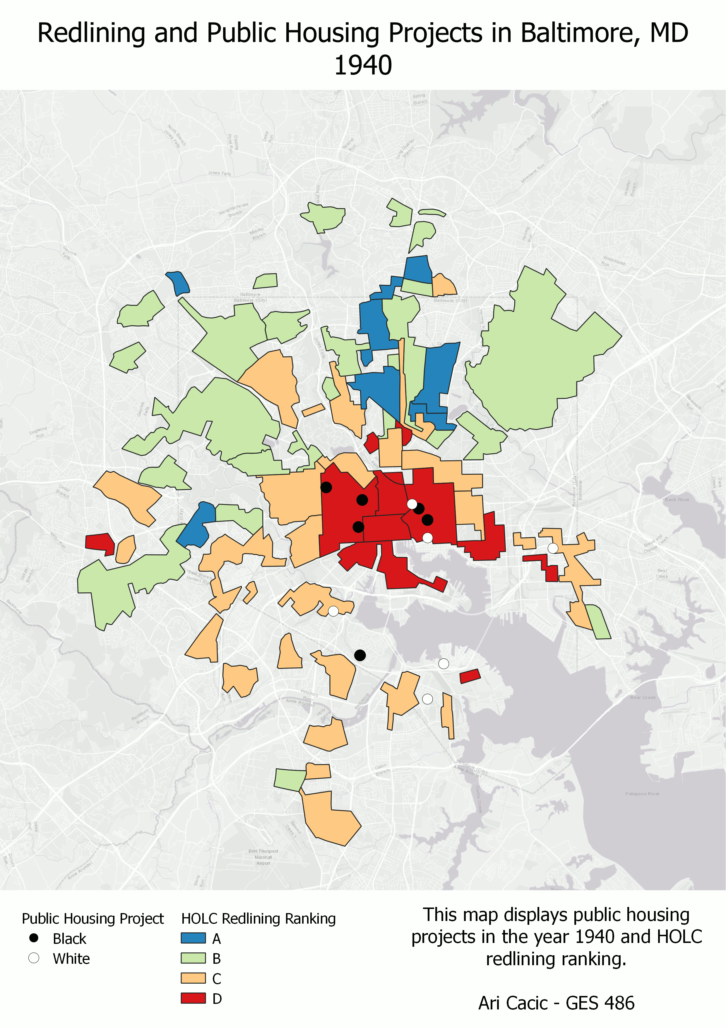
My second output is a GIF showing public housing projects in spatial relation to redlined areas and their severity from 1940 to 2010. The points are symbolized showing their racial composition, and the redlined areas are symbolized based on their HOLC ranking.